WHY CHOOSE

Ivan Geospatial Innovation

We Deliver Ontime, Everytime
We Do It Right The First Time
Your data is fully secured In our Office
we are working low cost with mutual benefits
IVAN GEOSPATIAL INNOVATION

ABOUT US

Ivan Geospatial innovation is a technical company aiming at serving the needs of the national and Global markets Through focused, innovation, efficient, quality products and services in all of geospatial industries. we are dedicated to the success and happiness all of our clients.

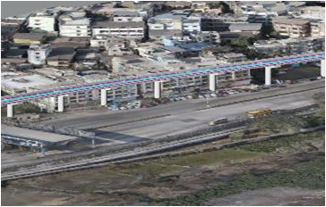
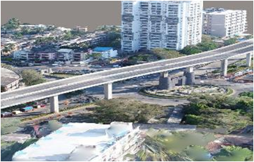
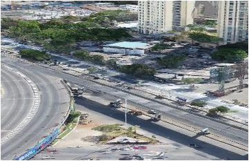
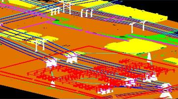
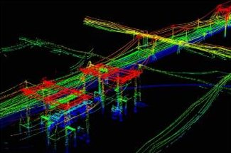
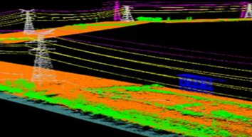
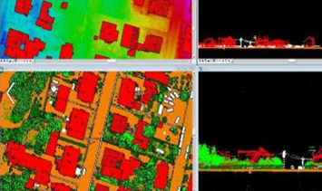
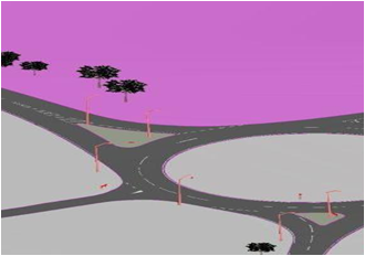
Ivan Geospatial innovation brings all of Mapping services with vast experience and expertise, provides the company strength to offer innovative, quality and effective solutions to all sectors of Government and Non Government Organizations.

SERVICES

Photogrammetry Services

  • 1 Aerial triangulation
  • 2 Stereo compilation
  • 3 DEM/DTM generation
  • 4 Planimetric features
  • 5 Contour generation
  • 6 3D City Modeling
SERVICES

Drone Services

SERVICES

Orthophoto Services

  • 1 Ortho generation
  • 2 Ortho mosaicing
  • 3 Color Balancing
  • 4 Edge matching
  • 5 Seam line Editing
  • 6 Tile cutting
SERVICES

Lidar Services

  • 1 DTM & DEM Extractions - Ground & Topographical classifications
  • 2 Power Line feature coding and centenary stringing
  • 3 Feature Extractions - Advance classifications like Building, Moving features, vegetation etc
  • 4 Corridor Mapping Contour
  • 5 Flood mapping
  • 6 Generation of Ortho photo using Terra photo
SERVICES

GIS Services

  • 1 Topographic Maps
  • 2 Cadastral maps
  • 3 Thematic Maps Generation
  • 4 Oil and Gas Pipe Line Data
  • 5 GIS Database Creation
SERVICES

Laser scanning Services

  • 1 3D Modeling (AutoCAD, Revit, cyclone modeling)
  • 2 SCAN TO BIM
  • 3 Solid modeling
  • 4 Surface texturing
  • 5 Tunnel Modelling
  • 6 3D Model Oil & Gas Station
  • 7 SCAN TO 2D DRAWINGS
SERVICES

INDUSTRIES

CONSTRUCTION
SMART CITY
INFRASTRUCTURE
AGRICULTURE
FORESTRY
UTILITY
MINING
LAND ADMINISTRATION
OIL & GAS

TEAM

BASIC

  • 7 Days a week operation
  • 3 Shifts of working in a Day.
  • Except government holidays.

WEEKLY PRODUCTION CAPACITY (Hours)

  • Aerial triangulation: 120 Hrs.
  • Stereo compilation: 768 Hrs. (Mapping Scale -1:20,1:40)
  • Orthophoto: 240 Hrs.
  • Drone Services: 360 Hrs.
  • 3D City Modeling: 408 Hrs.
  • Laser scanning: 360 Hrs.
  • Lidar: 600 Hrs.
  • GIS:720 Hrs.

OFFICE HOURS

DAYS 1st SHIFT 2nd SHIFT 3rd SHIFT
MONDAY 6am_2pm 2pm_10pm 10pm_6am
TUESDAY 6am_2pm 2pm_10pm 10pm_6am
WEDNESDAY 6am_2pm 2pm_10pm 10pm_6am
THURSDAY 6am_2pm 2pm_10pm 10pm_6am
FRIDAY 6am_2pm 2pm_10pm 10pm_6am
SATURDAY 9am_6pm Close Close
SUNDAY 10am_5pm Close Close

Contact us

Phone:
+91-9818-4702-09
Email:
info@ivangeospatialinnovation.com
Address:
Ashrivad Exotica ,Block 100, Ground floor, Rajaji Path, Ram Nagar, Dombivali East, Mumbai, Maharashtra, Pin 421201